Mastering the Nusa Penida Experience: A Comprehensive 3-Day Strategic Itinerary for Backpackers and Independent Travelers

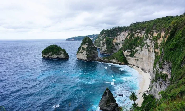
Nusa Penida, the largest of the three Nusa islands located southeast of Bali, has undergone a profound transformation over the last decade, evolving from a quiet agricultural outpost into one of Indonesia’s premier tourism destinations. Data from the Klungkung Regency Tourism Office indicates that visitor numbers to the island have surged by nearly 300% since 2017, driven primarily by the global virality of landmarks like Kelingking Beach. However, the island’s rugged terrain, characterized by steep limestone cliffs, winding narrow roads, and significant elevation changes, poses unique logistical challenges. For the independent traveler, efficient route planning is not merely a preference but a necessity to avoid the common pitfall of spending the majority of a holiday navigating the island’s taxing infrastructure.
The Logistical Reality of Nusa Penida
Geographically, Nusa Penida spans approximately 200 square kilometers. Unlike the flat coastal plains of Southern Bali, the island’s interior is dominated by high-altitude plateaus and treacherous cliffside tracks. Local transportation authorities report that the infrastructure, while being gradually upgraded, remains limited. For the average visitor, relying on a rented motorcycle requires a high level of riding proficiency. Traffic accidents involving tourists have become a recurring concern for local law enforcement, leading to increased calls for regulated transport services. A well-structured, three-day itinerary serves as both a framework for discovery and a safety precaution, ensuring travelers manage their time and energy effectively.
Pre-Departure Preparations and Safety Protocols
Before embarking on the journey from Sanur or Kusamba, travelers must address several foundational requirements. First, the selection of a reliable fast boat operator is critical, as departure times are often subject to weather conditions in the Badung Strait. Second, secure accommodation in the northern or central parts of the island, such as Toya Pakeh or Sampalan, to ensure proximity to main transport arteries.
Travelers should carry essential supplies, including high-SPF sunscreen, polarized sunglasses, and a reliable offline navigation tool, as cellular signal can be inconsistent in the island’s southern cliffs. Financial preparedness is also vital; while digital payment adoption is growing, cash remains the primary currency in local markets and remote stalls. Visitors are strongly advised to ensure their travel insurance covers motorcycle accidents, as this is the most common form of injury reported by local clinics on the island.
Day 1: Navigating the Western Coastal Circuit
The western quadrant of Nusa Penida houses the island’s most iconic, yet physically demanding, sites. A strategic arrival allows for a midday check-in followed by a direct excursion to the western loop. This region features the famous Kelingking Beach, Angel’s Billabong, and Broken Beach.

The descent to Kelingking Beach is a strenuous hike that requires adequate physical conditioning. Authorities have frequently cautioned against attempting this trek during the heat of the day. The proximity of these sites—Angel’s Billabong and Broken Beach—allows for a cohesive half-day trip. However, road conditions here are known to be some of the most difficult on the island. Travelers are urged to maintain low speeds and prioritize safety over speed, as the limestone-laden roads can be slippery even in dry conditions.
Day 2: Marine Biodiversity and the Eastern Terrain
The second day shifts focus toward the marine environment and the serene landscapes of the east. The waters surrounding Nusa Penida are part of a protected marine area, home to the elusive Manta Ray and the rare Mola-Mola. Snorkeling excursions typically depart from the northern harbors, heading toward Manta Point or Crystal Bay.
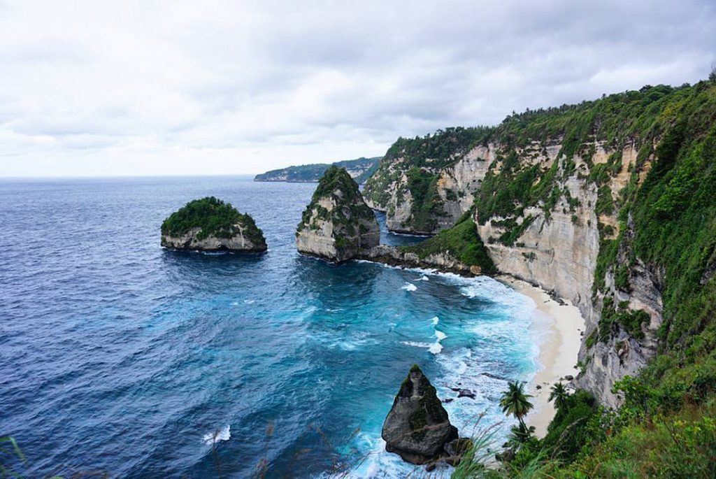
Following a morning of aquatic exploration, the afternoon should be dedicated to the eastern region, specifically the Diamond Beach and Atuh Beach areas. These sites offer a stark contrast to the west, characterized by white sand coves and dramatic rock formations. The eastern roads are generally less congested, though the steep descents to reach the beaches remain physically taxing. Environmental groups have recently increased their presence here, monitoring the impact of mass tourism on the delicate coral reefs and cliffside vegetation.
Day 3: Leisure, Logistics, and Departure
The final day of the itinerary is designed for integration and transit management. Travelers often make the mistake of attempting a final high-intensity activity before departure, which frequently leads to missing scheduled fast boat connections. The recommended approach is a relaxed morning in the central township, visiting local craft markets or cafes.
Logistically, passengers must aim to arrive at the harbor at least 90 minutes prior to their scheduled departure. The ferry system operates on strict time slots, and missing a boat can lead to significant delays in returning to mainland Bali. By finalizing check-outs and ensuring all transit documentation is in order by mid-morning, travelers can mitigate the stress of sudden itinerary disruptions.
Socio-Economic and Environmental Implications
The rapid expansion of tourism in Nusa Penida has brought significant economic benefits to the Klungkung Regency, creating jobs in hospitality, transport, and retail. However, this growth has also presented environmental challenges. Waste management, in particular, remains a persistent issue. The local government has implemented initiatives to promote a "zero-waste" culture, encouraging tourists to utilize refillable water bottles and strictly observe a "pack-it-in, pack-it-out" policy.
Furthermore, Nusa Penida maintains a deep cultural heritage. The island is dotted with hundreds of Hindu temples, many of which are considered sacred pilgrimage sites. Cultural sensitivity is mandatory; visitors are reminded to dress modestly when approaching temple grounds and to remain respectful during religious ceremonies. Local village councils (Desa Adat) have periodically issued guidelines for tourist conduct to ensure that the island’s spiritual life is not disrupted by the influx of visitors.
Analytical Perspectives on Future Tourism
Experts in sustainable tourism suggest that the future of Nusa Penida lies in transitioning from high-volume, short-stay tourism to a more curated, longer-duration model. By encouraging travelers to stay longer and explore beyond the "Instagram-famous" locations, the pressure on individual sites is reduced, and the economic benefits are more widely distributed among local guesthouses and restaurants.
The implementation of stricter traffic management and the potential development of a more robust public transport system could further enhance the visitor experience while improving safety. As it stands, the island remains a testament to the balance between natural beauty and human presence. The responsibility of maintaining this equilibrium falls not only on the regional government but also on the individual visitor.
In summary, a successful trip to Nusa Penida requires more than just a camera and a sense of adventure. It requires a disciplined approach to time management, a high regard for local customs, and a commitment to preserving the island’s ecological integrity. By following a structured itinerary that balances exploration with necessary downtime, travelers can experience the depth of the island’s landscape without succumbing to the fatigue often associated with poorly planned excursions. As the island continues to integrate into the global tourism market, those who visit with awareness and respect will find that Nusa Penida offers a profound experience that far exceeds the superficial allure of its most popular cliffside vantage points.